Team Dai Challenge 2014
Thailand and Laos share many similarities. From culture to language and even culinary delights, the two countries, which are predominantly separated by the Mekong River, hold an equal allure to cycling tourists the world over. So, when I was invited to participate in this year’s Team Dai Challenge, in support of Lao Disabled Women, I jumped at the opportunity to sink my teeth and tires into Thailand’s most kindred neighbor.
The 2014 edition of this long-running charity ride was to be four days of cycling along the Mekong River; a total of 475 kilometers with two days of riding in Thailand followed by two days in Laos.
Here is how it all played out –
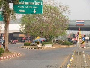
Day 1 – Thai/Laos border crossing between Nong Khai and Vientiane to Sangkhom, Thailand
Length: 80.13 km
Configuration: Point to point.
Download GPS file here (Zipfile contains .gdb and .gpx file formats)
The ride today was from the Thai side of the friendship bridge, which connects Laos and Thailand at the cities of Nong khai (in Thaialnd) and Vientiane (the capital of Laos), to Sangkhom, Thailand. Today’s ride distance was 80 kilometers and traveled along the Mekong River northwards to Sangkhom.
At the end of the day’s ride, we stayed at the Ban Mai Rimkhong hotel/guesthouse GPS – N 18 03.189, E 102 17.193 situated directly on the riverside with a beautiful view of Laos. Road condition for day 1 was: Paved 100%.
If you are looking for affordable and clean accommodation on the Thailand side of the border crossing, I would highly recommend Nong Khai Resort (Tel. 042-464958-9, 086-458-7293 GPS – N 17 51.962, E 102 43.858), which is conveniently located directly opposite the Nong Khai Railway Station. Depending on your travel plans you can take a train from Bangkok to Nong Khai with your bicycle and make the border crossing into Laos, or vice versa.
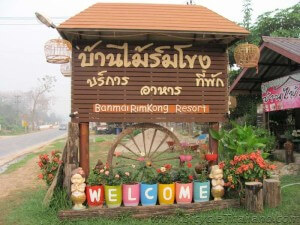
Day 2 – Ban Mai Rimkhong, Sangkhom to Chiang Khan
Length: 104.77 km
Configuration: Point to point.
Download GPS file here (Zipfile contains .gdb and .gpx file formats)
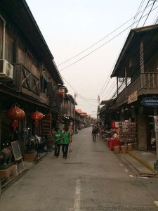
Today’s destination was the touristy riverside town of Chiang Khan, which is a cutesy little village that boasts a bustling main road (with Big C SuperMarket and chain hotels) and two side roads of arts and craft type shops that appeal to Thai tourists from the surrounding provinces. Today’s ride distance was 105 kilometers and traveled along the Mekong River northwards.
The theme in Chiang Khan is quaint, simple, and relaxed. Several guesthouses along the river are booked months in advance, but if you arrive on a weekday you’ll have no problem getting a room at one of the many boutique wooden riverside boutique spots that appeal to foreign and Thai holidaymakers. Your best lunch and dinner restaurant options, as well as evening shopping opportunities will be found along the small road that runs parallel to the river. Road condition for day 2 was: Paved 100%.
If the riverside shopping, restaurants, and boutique hotels are not to your liking you can always ride up to the main road and stay at the Chiang Khan Grand Hotel, which is right next to the Big C SuperMarket.
Day 3 – Chiang Khan, Thailand to Xanamkhan, Laos
Length: 124.51 km
Configuration: Point to point.
Download GPS file here (Zipfile contains .gdb and .gpx file formats)
Today, after approximately 50 kilometers of riding, we made the border crossing over to Laos GPS – N 17 41.360, E 101 23.620. The border crossing (which is a very small bridge) connects the Chiang Khan district, in Loei province (on the Thailand side) to Kenthao (on the Laos side). Today’s ride distance was approximately 125 kilometers and traveled for 50 kilometers northwards along the Mekong River on the Thai side, and another 75 kilometers southwards along the Mekong River on the Laos side, finally finishing at the town of Xanamkhan.
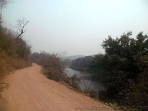
At the end of the day’s ride, we stayed at the Sonesavanh Guesthouse GPS – N 17 54.972, E 101 41.067, situated about two to three roads back from the Mekong riverside, which is coincidentally directly across from Chiang Khan (the Day 2 stopping point). Road condition for day 3 was: first 60 kilometers paved, second 60 kilometers dirt (roads had no shade and the dirt on several sections was like fine powder – MTB tires highly recommended), last 5 kilometers grated dirt (significantly easier to ride on than previous dirt section).
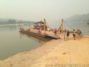
On today’s ride we made a Mekong River crossing via a ferry boat. This is a very short and very inexpensive ferry boat crossing. You may have to wait for a vehicle to arrive to the landing in order to take the large boat across the river, but there are small boats that will make the crossing for a passenger (and bicycle) for even less if you don’t fancy waiting around. The attached GPS file includes this crossing, but here are the details of the Ferry crossing and landing points:
Ferry crossing point: GPS – N 17 48.813, E 101 32.573
Ferry landing point: GPS – N 17 49.015, E 101 32.573
Day 4 – Xanamkhan to city center Vientiane, Laos
Length: 140.61 km
Configuration: Point to point.
Download GPS file here (Zipfile contains .gdb and .gpx file formats)
Today’s destination was the capital city of Laos, Vientiane. The ride distance was 140 kilometers and traveled along the Mekong River southwards all of the way to the capital city. Road condition for day 4 was: first 40 kilometers paved, second 60 kilometers dirt (roads had no shade but dirt was grated and significantly smoother and easier to ride on than the powdery dirt on Day 3), next 20 kilometers had intermittent road construction areas where new pavement was being laid, and last 20 kilometers was paved all of the way into the capital city center (attached GPS route ends at Patuxay Monument).
Looking for a hotel/guesthouse in Vientiane? I highly recommend the Vientiane Garden Hotel (Tel. +856-21 241964, +856-21 241963). Clean, comfortable place with decent breakfast and swimming pool. Definitely bike friendly (I kept my bike in my room, no problems). Also, there is a car wash station on the same street as this hotel that will pressure wash your filthy bike for 5,000 kip (about 20 Thai Baht).
GPS Location of Vientiane Garden Hotel: GPS – N 17 58.125, E 102 36.035
GPS location of Car Wash: GPS – N 17 58.123, E 102 35.988
Looking for a great coffee house in Vientiane? I highly recommend JOMA Bakery cafe.
GPS location of JOMA Namphou (on Setthathilath Road): GPS – N 17 57.875, E 102 36.423
GPS location of JOMA Phonthan (on Dongpaina Road): GPS – N 17 57.431, E 102 37.917
Looking for a Bike Shop in Vientiane? Visit www.BicycleLaos.com for GPS and Map locations of bicycle shops in Laos’ capital city as well as in Luang Prabang.
Big thanks – Thanks go out to Rik and Dirk for their organization of this annual event, Wolfgang for his invaluable ‘business’ ideas, and Melbourne Dave, who rode this entire route on a cyclocross bike.
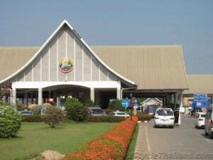
Want to get back to Thailand? Vientiane to Laos/Thai border crossing between Vientiane and Nong Khai
Length: 27.96 km
Configuration: Point to point.
Download GPS file here (Zipfile contains .gdb and .gpx file formats)
The ride form Vientiane city center is relatively easy. Simply ride from any area of Vientiane to the MAIN road that leads to the friendship bridge border crossing between Vientiane, Laos and Nong Khai, Thailand. The main road is THADEUA ROAD. From Vientiane city center it will be approximately 28 kilometers to the friendship bridge border crossing. The process to cross the friendship bridge is quite simple: queue up (with your bike) at any immigration departure window to get stamped out of the country you are leaving, cycle across the bridge (paying attention to which side of the road you are on – Thais drive on the left, while in Laos drivers use the right) , and queue up (again with your bike) at any immigration arrival window to get stamped in to the country you are arriving to.
Visa upon arrival in Laos (30 days) can be purchased in either US Dollars or Thai Baht. Visa upon arrival in Thailand (30 days) can be purchased in Thai Baht. Prices are dependent upon what country’s passport you hold. The paperwork process on the Laos side takes a bit more time and requires one 3.5cmX4.5cm photo. NOTE: Always bring your own pen. Finding a functioning pen at an immigration office or border crossing station is highly unlikely.
Are you looking for Laos GPS maps? Here is a great link that we have found very useful – http://www.laosgpsmap.com/
Learn more about the Team Dai Challenge at – https://sites.google.com/a/teamdai.org/team-dai/
Leave a Reply