Khao Mai Kaeo Mountain Bike Trails
Download GPS file here – (Zipfile contains .gpx and .gdb file formats)
Status: OPEN
Length: 10.8km
Configuration: Loop. 100% dirt
Start/End point: Main parking lot near snack shack
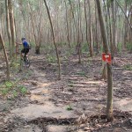
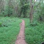
Notes: Trail is slightly better after rain because sandy areas get packed down. Steep climbs, root sections, technical singletrack. Trail has 90% tree canopy coverage.
Download GPS file here – (Zipfile contains .gpx and .gdb file formats)
Status: OPEN
Length: 4.2km
Configuration: Loop. 100% dirt
Start/End point: Main parking lot near snack shack
Notes: Trail is short and fun. Connect with Trail A (white) for a longer run. Short quick climbs, low hanging branches, root sections, technical singletrack. Trail has 90% tree canopy coverage.
Driving directions to Khao Mai Kaeo from Bangkok – Approximately 145km
[Download GPS file of these driving directions here – Zipfile contains .gpx and .gdb file formats]Go out to Suvarnabhumi airport using Rama IX. Take the Motorway (Highway 7) in the direction of Chon Buri (East).
After passing Suvarnabhumi airport, stay on Highway 7.
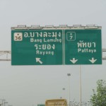
Before Chon Buri exit, and after the second tollway, the highway turns left in the direction of Pattaya (Chon Buri – Pattaya bypass). Stay on Highway 7 and follow signs to Pattaya.
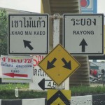
At the end of Highway 7 there is a junction, Pattaya is straight (under the bridge) and Rayong is to the
left. Take Route 36 to Rayong (photo 1).
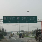
Drive about 800 meters and you will see a flyover above the highway.
Take Route 3240 to Khao Mai Kaeo (photo 2).
Turn left under the flyover in the direction of Khao Mai Kaeo (clearly marked) on Route 3240 (photo 3).
The drive to Khao Mai Kaeo from this point is approximately 6.5km. You will pass a Wat (temple) about 5 km on your right.
About 1 km after the Wat look out for a row of shop houses on the left and turn left immediately after into a small
street.
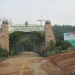
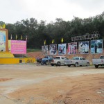
Follow this small street approximately 700 meters. Enter the park grounds (photo 4) and park your vehicle in the area next to the yellow stage (photo 5).
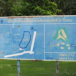
There is a trail board posted near the parking area (photo 6). Trail A and B can be ridden from this starting point.
Trailhead facilities: Bathroom, snack/drink shop, parking area
Fee: No fee
Leave a Reply